


- Sort by popularity
- Cancel
Showing 1–12 of 25 resultsSorted by popularity
-
 £235.00
Hanwag Tatra II Wide GTX Men’s
£235.00 Select options This product has multiple variants. The options may be chosen on the product page -
Dolomite 54 Low FG GTX
- The unmistakable Cinquantaquattro design transposed in a light and flexible shoe with a strong metropolitan soul. It’s the Cinquantaquattro Low Fg Gtx: a smart yet sporty shoe that combines the sleek and smooth lines of an urban shoe with the GORE-TEX technology to keep your feet fresh and dry in any conditions. Ideal to take you on any terrain.
-
KEY FEATURES
- Best for Everyday, travel, walks
- Ensures ultimate wearing comfort
- Made out of precious Oil Nubuk
- Waterproof GORE-TEX lining
- Vibram® Shock-absorbing Outsole
- Comes with a second pair of laces
£135.00£150.00Dolomite 54 Low FG GTX
£135.00£150.00Select options This product has multiple variants. The options may be chosen on the product page -
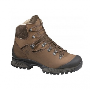
Hanwag Tatra Top GTX Men’s
Robust trekking boot with extra high upper. Recommended for marshes and boggy terrain – also available with a wider forefoot
suitable for
£240.00Hanwag Tatra Top GTX Men’s
£240.00 Select options This product has multiple variants. The options may be chosen on the product page -
Dolomite Cinquantaquattro Low FG Women’s GTX
KEY FEATURES
- Ensures ultimate wearing comfort
- Best for Everyday, travel, walks
- Designed for women’s feet shape
- Made out of precious Oil Nubuk
- Waterproof GORE-TEX lining
- Vibram® Shock-absorbing Outsole
- Comes with a second pair of laces
£135.00£150.00Dolomite Cinquantaquattro Low FG Women’s GTX
£135.00£150.00Select options This product has multiple variants. The options may be chosen on the product page -
Dolomite Tofana GTX Men’s
KEY FEATURES
- Best for long walks
- Long-Lasting Oiled leather
- Waterproof GORE-TEX lining
- Vibram® Outsole
- Lightweight and Grippy Outsole
£190.00Dolomite Tofana GTX Men’s
£190.00 Select options This product has multiple variants. The options may be chosen on the product page -
Dolomite Diagonal Gtx Men’s
The Dolomite Diagonal GTX is a great all-purpose outdoor shoe for everyday use, leisurely strolls and easy hill walks. It comes equipped with an EVA that provides excellent cushioning at all times. Plus, the shoes features to-the-toe lacing for a precise fit. Of course, the Diagonal GTX comes complete with a waterproof Gore-Tex membrane so that you can wear them in any weather, no matter whether you’re walking the dog or in the hills.
£124.99Dolomite Diagonal Gtx Men’s
£124.99 Select options This product has multiple variants. The options may be chosen on the product page -
Hanwag Bank Low GTX Men’s
Low cut, high comfort – a classic hiking shoe in high-quality nubuck and suede leather with a weather-protection GORE-TEX lining
£165.00Hanwag Bank Low GTX Men’s
£165.00 Select options This product has multiple variants. The options may be chosen on the product page -
Hanwag Tatra Lady
Particularly comfortable womens trekking boot with a lightweight, stable design
suitable for
£200.00Hanwag Tatra Lady
£200.00 Select options This product has multiple variants. The options may be chosen on the product page -
Cicerone Navigation Techniques and Skills for Walkers
This pocket handbook to navigation will help you master the necessary map and compass skills for mountain walking. Chapters include map scales, symbols and contours, grid references, map reading, bearings, route planning and night and bad-weather navigation, as well as navigating with a GPS.
£9.95 -
Cirerone Walking The South Down Way National Trail
Cicerone South Downs Way
This guidebook has all the information needed to walk the South Downs Way, a 100-mile (160km) national trail through the South Downs National Park between Winchester and Eastbourne. The route is described in both west–east and east–west directions, over 12 day-stages.
£17.95 -
Cicerone Walking The North Downs Way (National Trail)
A guidebook to walking the North Downs Way National Trail, a 130 mile (208km) walk between the high downland of Farnham and the historic city of Dover on the Kent coast, with an optional visit to Canterbury. The route is described in 11 stages, and is fully illustrated with colour photographs and OS map extracts. The North Downs Way is one of the easier national trails with a modest number of steep (but short) ascents and descents and long sections with no noticeable height gain or loss. Several historic sites including Neolithic burial chambers, Roman roads and Norman churches are passed and much of the route follows The Pilgrims’ Way. The area also boasts many literary connections with some of the most celebrated voices in English literature. A separate pocket-sized map booklet is included and shows the full route on 1:25,000 scale OS maps.
£16.95 -
Cicerone Walking The Thames Path
A guidebook to walking the Thames Path, a 180-mile National Trail from the Thames Barrier to the river’s source in near Cirencester, passing from central London through Windsor, Henley, and Oxford, and rural countryside. Described in 20 sections, of between 4 and 16 miles (6.5–32km), it is an mainly flat route with good access by public transport and typically takes two weeks to walk. On its way it passes historic sites such as Greenwich, Kew Gardens, Hampton Court, Runnymede, Windsor Castle and Oxford.
£17.95


You must be logged in to post a comment.